Add these epic Texas backpacking trails to visit for the ultimate outdoor adventure.
Hike along the Guadalupe Mountains, walk through a tunnel filled with 500,000 bats, and enjoy the towering pine trees in an East Texas forest. Texas offers endless trails to explore, diverse wildlife to encounter, stunning rock formations to climb, and state parks to visit. Below is the ultimate list of the best places to backpack in Texas.
North Texas Backpacking Trails
1. Cross Timbers Trail, Lake Texoma
The is a reservation-free camping spot in the Lone Star state, making it the perfect destination for a spontaneous hiking getaway.
A trail system of over 14 miles of trails begins at Juniper Point at the Willis Bridge and winds its way to Rock Creek Camp. Hikers will encounter a variety of terrains and wildlife, including snakes, coyotes, and bobcats.
Hikers will wind their way through a thick forest along the shoreline of Lake Texoma. Campsites are scattered along the trail and near the water’s edge.
Distance: 14.2 miles point-to-point
2. LBJ Grasslands Outer Loop – Decatur, TX
It’s probably a hidden gem for most. I had no idea this was only 25 minutes from where I live.
Texas Panhandle Backpacking Trails
3. Caprock Canyons Trailway, Caprock Canyons State Park
This trail is lengthy and desolate at times. Hiking through the flat Panhandle, the profusion of cotton fields, and bringing enough water are necessary. But scattered in the flat abyss is the abundant wildlife you will encounter.
This part of the Panhandle is where hikers encounter coyotes, bobwhites, snakes, turkeys, deer, and Texas raptors. Pass through the Clarity Tunnel to view the home of 500,000 Mexican free-tailed bats.
The long trail is well-maintained and follows the entire trek’s railroad track. History buffs will appreciate the sign along the path that gives information on the settlements and cattle drives that once passed through the area.
Distance: 64 miles point-to-point
4. Lighthouse Trail, Palo Duro Canyon State Park
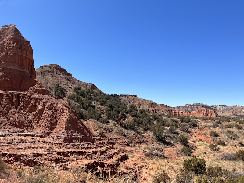
A trip to the second-largest canyon in the United States is a must-do. Spanning 120 miles long, 20 miles wide, and with a depth of over 800 feet, it’s no wonder it has the nickname of the Grand Canyon of Texas.
The Lighthouse Trail is the most popular hike in the park, known for its massive rock formation that resembles a lighthouse.
Rated as a moderate hike, the trail is mostly flat and sandy, taking you along the rock formations and offering stunning park views. Although this is a relatively smooth hike, hikers must do some rock scrambling to reach the flat plateau where the lighthouse formation stands.
The canyon can be deceiving, and in the summer, it can reach temperatures of up to 120° F, which is significantly hotter than the surrounding canyon rim. Hikers must ensure they bring the recommended one gallon of water per person and wear sunscreen, as there is little to no shade on the trail.
Distance: 5.6 miles point-to-point
Central Texas Backpacking Trails
5. Gorman Falls Trail, Colorado Bend State Park
A unique living waterfall is 65 feet of cascading water that becomes more prominent over time.
The trail consists of cactus- and limestone-covered paths, with occasional groves of trees that offer much-needed shade for hikers. The Colorado Bend State Park’s trail map has it marked as a challenging hike, but I think it is because the trail can sometimes be slippery.
Distance: 3.3 miles post to point
6. Painted Rock, Garner State Park
This is a heavily used trail at one of the busiest state parks in the Texas Hill Country. Garner State Park provides easy access to the Frio River and is a popular spot for launching tubes during the warmer months.
But don’t let the number of people in the park deter you! Once inside the park, take the Bridges Trail to Painted Rock Overlook, and the crowds begin to thin out. The trail is steep and can be challenging at times. But once you go to the top and check out the fantastic reviews, you will see that it was worth the climb!
Distance: 4 miles point-to-point
East Texas Backpacking Trails
7. Lone Star Hiking Trail, Sam Houston National Forest
Famous for being the longest hike in Texas, this 128-mile trail (including the five loop trails) is multi-day. If you don’t have multiple days, you can enter at a trailhead to hike any loops ranging from 5 to 13 miles.
Hikers will enjoy trekking through the thick pine forest, cypress swamps, and bayous of the Pineywoods of East Texas.
Distance: 96 miles point-to-point
8. The Trail Between The Lakes, Sabine National Forest
Wind your way through the Sabine National Forest. What makes this trail unique is that it passes through three distinct ecosystems: Pine Savannah, Bottomland Hardwood Forest, and Beech-Magnolia Canyons.
The trail takes hikers along Lake Toledo Bend, crossing multiple streams through the pineywood forest and hilly terrain. Its beautiful scenery and well-marked trails make this one of the best hikes in the area.
Distance: 28 miles point-to-point
South Texas Backpacking Trails
9. Mount Ol’ Baldy Trail, Garner State Park
A hike up Mount Ol’ Baldy is a must-do for stunning views of the beautiful Texas landscape.
Don’t be fooled by the short hike – you will climb up the entire way! Once at the summit, you can take a break and enjoy the expansive views of the Frio River.
Distance: 1-mile point-to-point
10. Lost Maples Extra Loop Trail, Lost Maples State Park
A popular trail that guides you around most of the park, birding, along the Sabinal River, and through a forest populated with the most concentrated numbers of maple trees in Texas.
The trail is labeled as a moderate hike, but it features several inclines and steep terrain throughout.
Distance: 7 miles from point to point.
West Texas Backpacking Trails
11. Santa Elena Canyon Trail, Big Bend National Park
A beautiful drive to the trailhead, stunning views of the canyon, and a mostly shaded hike are all reasons to enjoy this part of Big Bend National Park.
Take the Ross Maxwell Scenic Drive from Panther Junction to begin the hike. The trail descends to the banks of the Rio Grande, where the canyon comes into view.
As you go further into the hike, you will be 160ft above the Rio Grande and walking through the canyon walls that flank you on both sides. It’s a beautiful site and a fun hike.
Distance. 1.7-mile point-to-point
12. Chisos Mountain, Big Bend National Park
There are approximately 20 miles of backpacking trails through these mountains, which can take days to hike all. Most hikers limit their trips to 2-3 days due to the limited availability of water sources. Year-round camping, a lodge, and a restaurant are available in the Chisos Mountains—reservations are required.
Distance: 20 miles
13. Guadalupe Peak Trail, Guadalupe Mountains National Park
Guadalupe Peak is the highest point in Texas at 8,749 feet. This hike can be tough, with an elevation gain of over 3,000 feet and multiple switchbacks.
With little shade on the trail, be prepared for the Texas heat and bring plenty of water.
As you reach the summit, you will find the views of El Capitan to the South and the desert below you worth the trek.
Distance: 8.15 miles point-to-point
(From a reader) Guadalupe National Forest is home to McKittrick Canyon. This is a beautiful locale in the fall with spectacular fall colors and a fairly navigable hiking trail. Make sure you hike at least to the Grotto.
Also in my neighborhood is Hueco Mountains State Park. They limit the number of visitors, so it’s recommended to call ahead for a reservation. A very cool site featuring a bird estuary, Native American petroglyphs, and amazing carved-out rock formations.
14. Devil’s Hall Trail, Guadalupe Mountains National Park
Start from the Pine Springs Campground and follow a 1-mile maintained path before you get to the gravel, loose rock, and debris while walking over boulders until you get to Hiker’s Staircase. After climbing the stairs, a narrow path lies ahead. This trail is not for beginners. Bring a gallon of water per person.
Distance: 4.2 miles round-trip
15. Canyon Rim Trail, Seminole Canyon State Park & Historic Site
Ancient rock art, stunning views of the Rio Grande, and breathtaking canyon overlooks await hikers on the trails.
To access the Canyon Rim Trail, hikers must first take the Rio Grande Trail, which connects to the Canyon Rim Trail.
The trail had panoramic overlooks and shelters along the path. Be sure to stop and admire the Panther Cave Overlook, which has a 9-foot panther pictograph in the cave.
Distance: 9 miles point-to-point
There you have it – 15 epic backpacking trails in Texas. Try out these amazing day hikes in Texas for a soft adventure hike.
PIN IT!









When I saw the title “15 EPIC BACKPACKING TRAILS IN TEXAS,” I was expecting an article about backpacking trails (4 out of 15), not day hikes (the other 11 of the 15). If you are writing about day hikes, Enshanted Rock certainly needs to be included.
Also, Guadelupe Mountains National Park borders New Mexico, not Mexico.
I can certainly work on this article and get it right. Thank you, Kevin for your concern here.
I’m with Kevin Shaw. This article is misnamed. I was looking for backpacking trails, IE, trails that offer camping along the route. A lot of these do not have any campsites available along the route in question. I’ve been to Guadalupe Mountains, there is no camping permitted anywhere on the Devil’s Hall trail, nor along the Santa Elena trail in Big Bend.
As Kevin said, most of these are day hikes, not backpacking hikes.
Sorry there Fox – I did my best. I’ll check it again.
In Kim’s defense, I must say, a backpacking trip isn’t necessarily an overnight hike. If you’re going to be hiking a full day, you definitely want your backpack with you… unless you don’t want any water, food, or rest stops.
Thank you!
Guadalupe National Forest is home to McKittrick Canyon. This is a beautiful locale in the fall with spectacular fall colors and a fairly navigatable hiking trail. Make sure you hike at least to the Grotto.
Also in my neighborhood is Hueco Mountains State Park. They limit the number of visitors, so you might want to call ahead for a reservation. Very cool site that has a bird estuary, native american petroglyphs, and amazing carved out rock formations. Much like Enchantment Rock except 20x the area and scale.
OMG, thank you so much for this wonderful information. I’m going to add it to the article so all readers will know more about the area. I do hope to visit in the fall sometimes. Thanks again, KIM